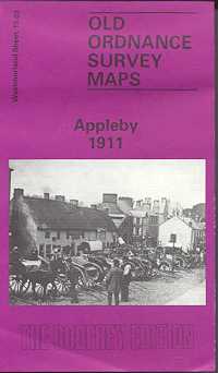
Appleby 1911
Old Ordnance Survey Maps of Westmorland:
£3.50
This detailed map is double-sided for maximum coverage. The main map covers the southern part of the town, with coverage extending from Boroughgate southward to Slosh and the Crown & Falcon Inn. Features include St Michael’s church, Parkinhill, Castle and Caesar’s Tower, Bongate Hall, River Eden, stretches of NER and Midland railways, Bongate Cross.
On the reverse we include a large part of adjacent sheet 9.15 extending coverage northward, and this includes the northern part of the town, including St Lawrence’s church, Moot Hall, Assize Court, Auction Mart, The Friary, both railway stations, Belgravia, Gallows Hill, Fair Hill, Hangingshaw, Grammar School, Battlebarrow House, etc.
publisher:
Godfrey
Publication Date:
1992
format:
Folded map.
ISBN:
850544807
illustrations:
Map.
