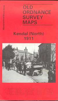
Kendal (North) 1911
Old Ordnance Survey Maps of Westmorland:
£3.50
This detailed map covers the northern part of Kendal, with coverage stretching from the railway station northward to Mint Bridge and Middle Sparrowmire, and from Hallgarth eastward to Spital and Fowl Ing.
Features include railway with station, goods station, Ale Stores, Auction Mart, Kendal Green, St Thomas church, Dockray Hall Mill, Mintsfeet, Sunny Brow, Workhouse, Airethwaite, Sparrowmire, Kentrigg etc.
The map includes extracts from a 1914 directory plus an 1897 timetable for the Windermere Branch,
The map links up with Kendal south.
publisher:
Godfrey
Publication Date:
1991
format:
Folded map.
ISBN:
9781847848123
illustrations:
Map.
